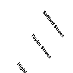
13-15 TAYLOR ST
Owner Information
FRANCIS JOHN G & JANE E
13-15 TAYLOR ST
QUINCY, MA 02170


Property Details
13-15 TAYLOR ST is classified as a Two-Family Residential (2 fam flat).
The primary structure on this property was built in 1930. There are 3,869ft2 of built area within this property. There is 2,304ft2 of residential/living space within this property. This property is listed as having 11 rooms.
13-15 TAYLOR ST is valued at $676,600. The land is valued at $252,600 and the structures are valued at $411,000. There is an additional valuation of $13,000 on this property.
This property is in Zone RES A. Confirm with local Zoning Board authorities to ensure there are no overlays or other easements on this property.
The most recent deed for 13-15 TAYLOR ST is recorded at the local registrar in Book 19871, Page 0280. 13-15 TAYLOR ST was last sold on Tuesday, September 16, 2003 for $0.
Assessment data from fiscal year 2020.
Flood Data
According to the FEMA National Flood Hazard Layer, this property does not appear to be in a flood zone. It may also be in an area not yet reviewed. Nonetheless, confirm this information prior to taking any action.
To view the flood hazards around this property, create a FEMA "Firmette" Map of the area around 13-15 TAYLOR ST.
Broadband Internet Providers
| Provider | Type | Bandwidth (mbps) | |
|---|---|---|---|
| Verizon New England Inc. | DSL | 10 | 1 |
| Viasat Inc | Satellite | 100 | 3 |
| Starry, Inc. | Fixed Wireless | 200 | 200 |
| GCI Communication Corp. | Satellite | 0 | 0 |
| HughesNet | Satellite | 25 | 3 |
| VSAT Systems, LLC. | Satellite | 2 | 1 |
| Comcast | Cable | 1000 | 35 |
Broadband service provider data from December 2020.
Adjacent Properties
- 80 HIGHLAND AVE
Single Family Residential owned by GAO XYE HAI - 86 HIGHLAND AVE
Single Family Residential owned by SHERIDAN SUSAN E - 82 HIGHLAND AVE
Single Family Residential owned by FARRELL WILLIAM G - 17 TAYLOR ST
Single Family Residential owned by CARSON JEANNIE C - 9 TAYLOR ST
Two-Family Residential owned by CHERRY JOHN SCOTT